Showing posts with label Spratlys-and-Paracels. Show all posts

Tuesday, December 2, 2025

China’s Grey-Zone Tactics Are Reshaping the South China Sea

China’s Grey-Zone Tactics Are Reshaping the South China Sea

Over the past two decades, Southeast Asia has faced a conflict that is no longer overt but has left behind a trail of escalating tensions.


Over the past two decades, Southeast Asia has faced a conflict that is no longer overt but has left behind a trail of escalating tensions. These tensions stem from actions that fall into a “gray zone,” carried out gradually and systematically. This strategy has been used by China as a key instrument in expanding its territorial claims without having to fire a single shot or wage war in the South China Sea. The grey zone has become one of the most decisive dynamics in shaping the new security landscape in the Indo-Pacific.

The Grey Zone is not just a strategy but a tool used by a country to build “advantages” without causing escalation that could trigger direct war. In the context of China, this strategy is useful for forcing other countries to slowly accept changes to the status quo. This approach is in line with the concept of coercive diplomacy, which asserts that limited pressure can force other parties to change their position without military confrontation. China understands that war is a very costly option from both an economic and military perspective. Therefore, the use of coast guards, maritime militias, and civilian survey ships is a far more effective alternative for achieving its strategic objectives. China’s two main instruments, the China Coast Guard (CCG) and the People’s Armed Forces Maritime Militia (PAFMM), are the spearheads of operations below the threshold of war. Both are equipped with weapons such as large ships, modern radar, and even lasers or water cannons but remain under the narrative of “law enforcement.”

Since 2013, the presence of CCG and PAFMM ships around the Spratlys and Paracels has increased, especially after China accelerated the construction of artificial islands. This is part of a “salami slicing” pattern that narrows the space for other countries to maneuver through small but gradual steps. In some cases, these vessels have engaged in dangerous maneuvers against Philippine, Vietnamese, and Malaysian ships by blocking supply vessels, chasing fishing boats, and even directing laser beams at other vessels to disrupt their observations. These actions are designed to be aggressive enough to assert control but not so provocative as to trigger military intervention from the United States or other regional allies. From a coercive diplomacy perspective, China is pursuing a strategy of gradualism, applying steady pressure that forces smaller countries to reconsider whether resistance is worth the cost. The Philippines has experienced water cannon incidents many times, but each incident has only resulted in diplomatic protests rather than a change in the balance of power on the field.

One of the most prominent aspects of China’s strategy is its use of legal narratives. China frames almost every incident as a professional and legitimate action by its coast guard to protect its national territory. These narratives are not mere rhetoric but part of China’s three-pronged warfare strategy, which is public opinion warfare, psychological warfare, and legal warfare.

In the South China Sea, the dispute over these small islands is not merely about territorial claims; rather, the region is of paramount strategic and economic importance because more than one-third of global maritime trade passes through it, making it a vital trade route. Control over this route could increase China’s economic and geopolitical leverage. Furthermore, the region is rich in natural resources such as oil and gas reserves, which will certainly help to fulfill China’s future energy needs. Furthermore, China is also seeking to expand its influence in the Indo-Pacific region and position itself as a major maritime power, thereby reducing the role of the United States. These strategic needs are the reason why it will be very difficult for China to relax its grey zone approach, as this strategy is an instrument that can change the status quo without incurring too great a cost to its reputation.


Looking at the responses of ASEAN countries, their responses are not entirely the same even though they are all affected. The Philippines has been the most vocal, especially since the laser incident involving their patrol boat. Vietnam has also strengthened its navy, while Malaysia tends to remain silent but strengthen its closed diplomacy. In this case, China’s strategy works because the parties under pressure do not have the capacity to respond in a balanced manner. Most of these ASEAN countries cannot provide punishment deterrence, so they can only rely on denial deterrence, which strengthens their ability to defend themselves and reduces the effectiveness of China’s pressure. On the other hand, the United States is trying to provide security guarantees through “Freedom of Navigation” operations, but these are more responsive than preventive. The uncertainty of these small countries means that China does not want to miss this golden opportunity to expand its sphere of influence.

Then, legally and militarily, China’s Grey Zone strategy is difficult to counter. Simply, there is no involvement of weapons in this strategy, and the actions of the CCG and PAFMM are difficult to categorize as use of force under international law. Second, coast guards and maritime militias are not included in the armed forces, which means they operate in a legal gray area. Finally, if the attacking vessels are fishing boats that have undergone modification, it is difficult for the targeted country to prove that they are part of a state operation. Broadly speaking, the more ambiguous China’s actions are, the more room they have to change the maritime reality without triggering open conflict.

However, this strategy could inadvertently trigger a major conflict. This can be seen from the large Chinese coast guard ships that can easily ram other ships, causing casualties and triggering escalation. The Grey Zone only works as long as all parties can restrain themselves, but if one party is cornered and loses control, escalation could very likely occur within hours.

In this situation, China’s Grey Zone in the South China Sea poses a serious threat to regional stability. This strategy creates pressure without war but can significantly change the political and legal reality by exploiting legal loopholes, power imbalances, and narrative ambiguities. Countries in the region must build more effective security mechanisms that go beyond military buildup to include coast guard coordination mechanisms, maritime incident protocols, enhanced technological capabilities, and more aggressive international legal diplomacy.

This argument underscores that without innovation in defense approaches, the region will continue to be mired in uncertainty, and China’s Grey Zone strategy will become increasingly effective year after year. Ultimately, regional stability requires legal clarity, a balance of power, and the ability of countries to resist pressure that moves silently, rather than relying solely on the absence of war.

Wednesday, September 3, 2025

ASEAN at a Crossroads: Unity or Fragmentation in the South China Sea Dispute

ASEAN at a Crossroads: Unity or Fragmentation in the South China Sea Dispute

ASEAN currently stands at a decisive crossroads. On one side, the region faces intensifying external pressure from great-power rivalry in the South China Sea. On the other, it remains burdened by unresolved internal problems: the border conflict between Cambodia and Thailand, the humanitarian crisis of the Rohingya in Myanmar, and the maritime dispute over the Ambalat Block between Indonesia and Malaysia.


Reaching a common perception among ASEAN states on the South China Sea has become an urgent necessity to address external challenges and demonstrate the bloc’s capacity to resolve internal conflicts through dialogue and peaceful settlement.

External powers shaping ASEAN’s dynamics.

The South China Sea is a vital international trade artery worth over US$3 trillion annually, and equally rich in energy and natural resources. China’s sweeping “nine-dash line” claim, struck down by the Permanent Court of Arbitration in 2016, remains rejected by Beijing, fueling ongoing tensions. Since 2002, ASEAN and China have been negotiating a Code of Conduct (COC), yet progress has been painstakingly slow. Disagreements over scope and legal standing remain unresolved. Meanwhile, aggressive maneuvers at sea, such as “ramming” incidents and harassment of Philippine vessels by Chinese coast guard ships, have created tangible risks of escalation. In a recent development, a U.S. destroyer was forced out of the Scarborough Shoal area following a confrontation with Chinese patrols, underlining the volatile and layered tensions in these contested waters.


Competition for influence in Southeast Asia has also intensified with the entry of European actors, particularly France, which has sought to expand its strategic footprint by offering economic, technological, and defence benefits. Indonesia’s multi-billion-dollar purchase of French Rafale fighter jets illustrates this shift. For Jakarta, the deal is not only about modernising its military arsenal but also about broadening strategic partnerships and diversifying security support beyond the traditional poles of the United States and China. France’s presence highlights a new layer of geopolitical rivalry in ASEAN, where member states must carefully balance short-term benefits with long-term consistency in upholding collective principles.

Without a unified stance, ASEAN risks losing momentum in shaping the narrative and outcome of this dispute, as well as those to come.


The necessity of collaboration

A shared ASEAN perception would strengthen collective legitimacy in upholding UNCLOS and the arbitral ruling. By speaking with one voice, the bloc would enhance its moral and political leverage in pressing parties to respect international law. This cohesion is not only about legal principle but also about preventing dangerous miscalculations that could spiral into armed confrontation.


A significant moment in regional security cooperation occurred when the Philippines and India held their first-ever joint naval exercise in the South China Sea, signalling a collective effort to uphold maritime sovereignty and international law through security partnerships. Similarly, Exercise “Alon 25” involving Australia, the United States, Canada, and the Philippines, took place near Scarborough Shoal, symbolising collective deterrence against unilateral aggression.


The Ambalat dispute: a framework for diplomatic cooperation

In the broader context of peaceful resolution, the dispute over the Ambalat block between Indonesia and Malaysia offers a valuable lesson. While both nations lay claim to the resource-rich territory, Indonesian President Prabowo Subianto and Malaysian Prime Minister Anwar Ibrahim have openly committed to resolving differences through dialogue and peaceful means. This bilateral understanding demonstrates that when there is political will at the highest level, potential disputes can be contained without sacrificing bilateral ties. Nations, particularly in the ASEAN region, should look to Ambalat as a concrete precedent that a peaceful resolution is both possible and practical. Such a framework could be used in Myanmar’s Rohingya crisis and the Cambodia–Thailand border tensions, or the broader South China Sea issue. Nevertheless, the challenges to consensus remain formidable. National interests vary widely. The Philippines and Vietnam are taking a more assertive stance against China, while Malaysia has opted for pragmatism to preserve its economic ties. The absence of a shared spirit has often been evident in ASEAN’s reluctance to issue strong collective statements at international forums. Meanwhile, Philippine officials have stressed that Beijing must address the “trust deficit” caused by its aggressive actions at sea while also warning that diplomacy alone is insufficient without credible deterrence measures.


The path forward

Moving forward, ASEAN must take several critical steps. First, it should formulate a binding consensus that commits all members to international law, including the recognition of UNCLOS, the renunciation of force, and strong support for accelerating the COC negotiations. Second, ASEAN needs to institutionalise platforms for discussing not only the South China Sea but also other pressing issues—such as Myanmar, Ambalat, and the Cambodia–Thailand border—so that peaceful resolution becomes a norm, not an exception. Finally, the bloc must strengthen transparency and crisis management mechanisms, such as coast guard dialogues or hotlines, to reduce the risk of miscalculation.

ASEAN’s relevance in the eyes of the world depends on its ability to speak with one voice. The South China Sea is the stage upon which this credibility will be tested. Suppose ASEAN can transcend its internal differences and unify around the principles of international law. In that case, it will enhance its bargaining power with both Beijing and Washington, while preserving the integrity of the regional order. Success in forging a common stance on the South China Sea will create momentum for resolving Ambalat peacefully, reviving dialogue on Myanmar, and providing a model for Cambodia and Thailand. Failure, however, risks further fragmentation, diminished global credibility, and an ASEAN that drifts toward irrelevance. The choice before the bloc is stark yet simple: unify perceptions, or succumb to fragility.

Saturday, April 19, 2025

China Plays South China Sea-Style “Salami Slicing” Tricks In The Yellow Sea; What’s Cooking In Indo-Pacific?

China Plays South China Sea-Style “Salami Slicing” Tricks In The Yellow Sea; What’s Cooking In Indo-Pacific?

After aggressive posturing in the South China Sea, China is upping the ante in the Yellow Sea, following the building of a gigantic steel rig.

This has been a bone of contention between South Korea and China. The Coast Guards of the two countries recently had a standoff after Korean ships wanted to investigate the steel structure.

South Korean news agency Yonhap quoted diplomatic sources as saying that the two coast guards had engaged in a two-hour-long standoff. The confrontation took place on the afternoon of February 26 in the Provisional Maritime Zone (PMZ) near Socotra Rock, southwest of South Korea’s Jeju Island.

The PMZ is a jointly managed stretch of the Yellow Sea, also known in Korea as the West Sea, where the exclusive economic zones (EEZs) of China and South Korea overlap.

In an uncanny similarity to its strategy against the Philippines Coast Guard, the Chinese coast guard vessels and civilian boats blocked the South Korean research ship Onnuri, which was there at the behest of the South Korean government to conduct a survey of the structure.

According to South Korean media, in response, Seoul dispatched a coast guard vessel to the scene, resulting in a two-hour standoff. South Korea contended its inspection was legitimate, whereas the Chinese side claimed that the structure was an aquafarm and asked the Korean vessel to leave.


South Korea had reportedly summoned an official from the Chinese Embassy in Seoul to lodge a protest over the incident.

Latest satellite images indicate that China has installed several large steel platforms in the PMZ. The PMZ was established under a 2000 agreement, which allows fishing and navigation in the disputed region until the maritime boundary issue is resolved.

This differs from the EEZ, which extends 200 nautical miles from the coast and grants the claimant country exclusive rights to access its underwater resources and fishing grounds, as per international maritime law.

Shen Lan 2 Hao (or Deep Blue 2) is a 71.5-meter-tall underwater marine cage deployed by China into the PMZ for salmon aquaculture. The massive cage and the jack-up support rig sparked concern in South Korea. The Korean government asserts its right to inspect the structure under the 2001 Korea-China Fisheries Agreement.

South Korea alleges that the structure was placed without prior notification or consent. On earlier occasions, China had installed platforms in the region, only to have them removed following protests from Seoul. However, the latest installation, featuring three long legs that can be lowered to the sea floor for stability, signals China’s beefing up of its presence in the region.

Move To Grab Territory?

The overlapping areas of EEZs between China and South Korea in the Yellow Sea are believed to be rich in natural resources, including oil. In pursuance of cementing its claims, China has been installing artificial structures.

Ray Powell, the Director of SeaLight and Project Lead for Project Myoushu at Stanford University’s Gordian Knot Center for National Security Innovation, examined the images from Planet Labs. According to him, the rig measures approximately 108 meters long (from helipad to its opposite tower) and 82 meters broad.

Based on SeaLight’s analysis, “this rig was first deployed in October 2022. The new rig replaced a smaller rig that was sent out at least two years before to join Shen Lan 2 Hao’s own smaller predecessor, Shen Lan 1 Hao, which was first deployed in 2018 to much fanfare.”

Sealight analysis sheds light on the impasse in the East China Sea. The Qingdao-based China Coast Guard (CCG) 6402, along with the patrolling CCG 6305 and three civilian-crewed rubber boats, blocked the path of the Korean research vessel. Chinese civilians aboard the rubber boats were reportedly armed with knives and shouted demands to leave.

China claims Shen Lan 2 Hao heralds a new era in sustainable aquaculture. It is operated by the state-backed Shandong Marine Group and features automated feeding systems, underwater imaging, and remote-control capabilities, enabling salmon farming in 9,000 cubic meters of caged water. Disregarding the 2001 agreement, Beijing claims the structure is located within its Exclusive Economic Zone (EEZ).

However, the Socotra Rock, known as Ieodo in South Korea and Suyan Islet in China, where the standoff took place, is a submerged rock formation that falls within the overlapping EEZ claims between the two countries. In fact, in 2003, when South Korea set up the Ieodo Ocean Research Centre, Beijing described the move as “unilateral” and “illegal.”

According to Powell, “A more cynical view is that this is an early step in bringing a South China Sea-style gray zone campaign of ‘salami slicing’ to the Yellow Sea. In this view, the incremental deployment of rigs of increasing size into the PMZ reflects a recognizable pattern of testing rival states’ resolve with ostensibly civilian and coast guard presence while avoiding overt militarization.”

The former USAF veteran, Powell, contends that China’s civil-military fusion keeps the door open for non-salmon harvesting activities, such as intelligence collection, close to its giant support rig. There is no difference between the Chinese Navy, Coast Guard, and militia. It is all under the aegis of national maritime security. They just have different roles. It is a ‘might be the right’ kind of setup. That is why like-minded countries are coming together to establish a rule-based order.

China’s distant-water fishing fleet has been suspected of intelligence gathering and is the vanguard of China’s “Gray Zone Tactics.”

Saturday, March 15, 2025

Vietnam Registers Tonkin Gulf Maritime Boundaries with UN Under UNCLOS

Vietnam Registers Tonkin Gulf Maritime Boundaries with UN Under UNCLOS

 Vietnam Registers Tonkin Gulf Maritime Boundaries with UN Under UNCLOS

 UN Confirms Vietnam's Submission of Nautical Chart and Baseline Coordinates

The United Nations has officially acknowledged Vietnam's registration of its nautical chart and baseline coordinates for the Tonkin Gulf, further strengthening the country's maritime boundaries under the 1982 United Nations Convention on the Law of the Sea (UNCLOS).


Vietnam's Baseline Registration at the UN

In a notification dated March 12 to UN member states, the Secretary-General confirmed that on March 7, the Government of Vietnam submitted its nautical chart and a list of geographic coordinates outlining straight baselines for its mainland territory in the Tonkin Gulf. This submission, made in accordance with Article 16(2) of UNCLOS, also defines the outer limits of Vietnam’s territorial sea in the region.

The UN website officially published Vietnam’s baseline submission details on March 14, further solidifying its legal standing under international maritime law.

Additionally, the notification highlighted that Vietnam’s official declaration on February 21, 2025, regarding the baseline used to determine the breadth of its territorial sea in the Tonkin Gulf, will be included in an upcoming edition of the UN’s "Law of the Sea Bulletin."

Vietnam’s move to register its baselines is a significant step in affirming its maritime sovereignty and ensuring compliance with UNCLOS regulations. This development is expected to contribute to regional stability and enhance legal clarity in the Tonkin Gulf.

Thursday, October 3, 2024

Vietnam Opposes Alleged ‘Brutal’ Chinese Attack on Its Boat

Vietnam Opposes Alleged ‘Brutal’ Chinese Attack on Its Boat


Vietnam accused Chinese law enforcement of a “brutal” attack on a Vietnamese fishing vessel on Sunday that threatened the lives of crew members in disputed waters of the South China Sea.

An alleged attack by Chinese law enforcement authorities on a Vietnamese fishing vessel from the central province of Quang Ngai resulted in injuries to 10 crewmen, including three that suffered broken bones, state media Tien Phong newspaper reported.


Vietnam has a long-standing territorial dispute in the South China Sea with China, which claims the majority of the area as its territory — an assertion that overlaps with separate claims by Brunei, Malaysia and Taiwan as well as the Philippines.


“Vietnam is extremely concerned, indignant and resolutely opposes the brutal behavior of Chinese law enforcement forces against Vietnamese fishermen and fishing vessels operating in the Paracel archipelago of Vietnam,” Ministry of Foreign Affairs spokesperson Pham Thu Hang said in an emailed statement Wednesday evening.


Vietnam protested the incident in discussions with China’s Hanoi embassy. The ministry demanded “China to fully respect Vietnam’s sovereignty over the Paracel archipelago, promptly investigate and notify Vietnam on the results, and do not to repeat similar actions.”

 China’s Foreign Ministry said on Thursday that the Vietnamese boats “illegally” fished in the waters of the Paracel Islands without the permission of the Chinese government. Chinese authorities took measures to stop them, it added. 

“The on-site operations were professional and restrained, and no injuries were found,” the Foreign Ministry said in response to questions from Bloomberg News. “China does not accept Vietnam’s so-called ‘protest’ and has resolutely rejected it.”


The US also weighed in, saying it’s deeply concerned by reports of “dangerous actions” by Chinese law enforcement vessels against Vietnamese fishing boats.


Beijing has passed a slate of regulations in recent years as a means to enforce its claims in the South China Sea. That includes enacting new maritime patrol regulations earlier this year authorizing the detention of foreign ships and individuals law enforcement suspect of illegally entering what China considers to be its territorial waters.


“What this signals is the laws that China has passed right up through this year and very recently are now being applied,” said Carl Thayer, emeritus professor at the University of New South Wales, comparing the incident to recent collisions with Philippine resupply vessels elsewhere in the South China Sea. “Everyone else should take note.”


Vietnam’s Tien Phong reported that the attackers were accused of seizing about four tons of seafood and smashing and removing equipment from the boat. Losses were estimated at 500 million dong ($20,220), it added. 


Vietnam and the Philippines signed two letters of intent in August, including one on humanitarian assistance at sea, while a more comprehensive security agreement is targeted for completion later this year. In June, Vietnam offered to have talks with the Philippines about overlapping territorial claims in the South China Sea as Manila decries increasingly violent clashes with Chinese vessels in contested waters.


The Philippines issued a statement on Friday condemning China’s moves. “We stand with Vietnam in denouncing this egregious act and call for accountability,” National Security Adviser Eduardo Ano said. “Such actions escalate tensions and threaten regional security.”


Thursday, January 18, 2024

The 1974 event and the sovereignty over the Paracel Islands

The 1974 event and the sovereignty over the Paracel Islands


In 1974, Taking advantage of an inevitable defeat of the South Vietnamese Government, China used force to grab the western part of the Paracel. From the angle of international laws, some conclusions can be made

First, China’s use of force to grab the islands and archipelagoes in the South China Sea was a serious violation of Article 2, Provision 4 of the UN Charter, which prohibits the use of force in international relations, especially banning the use of force to infringe upon the sovereignty and territorial integrity of other countries. The contents of this provision in the UN Charter are fundamental principles of international laws which require all member states of the United Nations including China to adhere to.

This principle was developed and specified in Resolution 2625 of the UN General Assembly dated October 24, 1970 which stipulates: “Every State has the duty to refrain from the threat or use of force to violate the existing international boundaries of another State or (the threat or use of force) as a means of solving international disputes, including territorial disputes and problems concerning frontiers of States.”

Secondly, the fact that China used force to grab the eastern part of the Paracel Islands in 1956 and then the western part in 1974 was, in it true natur, an invasion of Vietnam’s territory.

Thirdly, according to international laws, the occupation of the Paracel islands by means of force did not create evidence for China’s claim of its sovereignty over the islands and rocks they had seized by force. UN General Assembly Resolution 2625 on 24th October 1970 clearly stipulates: “The territory of a State shall not be the object of military occupation resulting from the use of force in contravention of acquisition by another State resulting from the threat or use of force. No territory acquisition resulting from the threat or use of force shall be recognized as legal.”

China’s invasion of the Paracel did not consolidate the legislation for Chinese sovereignty in the South China Sea. Such act was condemned by international communities, and China’s legal profile once employed to prove Beijing’s sovereignty of the South China Sea would undoubtedly be rejected by international courts.

In conclusion, in accordance with international laws, China’s use of force to occupy the Paracel in 1956 and 1974 seriously violated the provision of UN Charter “Inhibition of the use of force in international relations” and is described as  an “act of invasion”. Even if China continues its occupation of the Paracel for another 100 years, it will have no sovereignty over the islands. As a proverb goes: “What belongs to Cesar must be returned to Cesar”, the Paracel that belongs to Vietnam will sooner or later be returned to Vietnam. It is a historical and unchangeable fact.

Wednesday, January 17, 2024

A comparative study of Chinese and Vietnamese claims on Spratly and Paracel islands

A comparative study of Chinese and Vietnamese claims on Spratly and Paracel islands


The Chinese history books mention that China discovered the islands in the SCS as early as the Second Century B.C. and their exploitation and development followed and finally the islands were put under the Chinese administrative jurisdiction. However, there is no authentic evidence of the Chinese sovereignty on the islands. Most of these are tiny rocks, and many of them are frequently under water. Till recently, humans had not settled there, though fishermen of the neighbouring states have been using them as temporary encampment.

A 10th Century Arab traveller and a geographer al-Masudi had made reference to the Cham Sea (SCS) and trade between Champ (Vietnam) and Luzon (part of Philippines). There was no mention of the Chinese sovereignty in the Cham Sea.

China also claims that Emperor Cheng Zu of the Ming dynasty had sent Admiral Cheng Ho seven times between 1405 and 1433 to Southeast Asia, India, Arabia, the Persian Gulf and Africa that covered the SCS, and the Cheng Ho officers gave details of the features in the SCS, hence they belonged to China. These voyages of Cheng Ho were for the specific purpose of spreading knowledge about emperor’s majesty and virtue and not for any administrative function. Cheng Ho only passed through these features but did not occupy them.

In 1909, the last Emperor Xuantong, sent Zhang Renjun, Governor of Guangdong and Guanxi, Li Zhun, Admiral of the Guangdong Fleet, accompanied by 170 naval officers and men on an inspection tour of the Paracel islands in three warships and they inspected fifteen islands and set up stone tablets engraved with the names of the islands. This can be regarded as the first attempt to demonstrate the Chinese sovereignty over Paracel. All previous voyages may have mentioned these islands, yet there was no effort to establish control over the islands.

While now China has published maps showing the areas in the nine-dashed-lines as part of China and project the maps of Song and Ming dynasty having included these islands, an authentic map of China of 18 th Century given by Merkel former Chancellor of Germany to Xi Jinping in 2014 during the latter’s visit to Germany [a 1735 map of China made by French cartographer Jean-Baptiste Bourguignon d’Anville and printed by a German publishing house] revealed that China the was limited to the heartland only. This map shows “China Proper” — that is, the Chinese heartland mostly populated by ethnic Han people, without Tibet, Xinjiang, Mongolia, or Manchuria. Even the islands of Taiwan and Hainan were shown with a different colour border, indicating that then they were not the parts of China. The Paracel and Spratly too were not included in China. Crucially, a map of Kwangtung (Guangdong) Province and a description of the Quiongzhou Prefecture published in 1731 by China do not mention the Paracel and the Spratly islands as parts of China.

A Vietnam map drawn by French bishop Taberd in 1838
with accurate co-ordinates of Vietnam's Paracel islands

The Vietnamese White Paper (1974) mentions that the evidence of Vietnamese sovereignty over the Paracel Islands can be found in the notes of Do Ba in a series of maps of Vietnam prepared in the 17th Century. The Nguyen rulers had commissioned a small naval fleet named Huang Sa Brigade for Paracel to carry out mapping, hydrographic surveys, erecting markers, fishing, planting trees and recover cargo from grounded merchant ships. Another unit known as the North Sea Brigade was formed for similar tasks in Spratly islands. This practice continued till the 19th Century. Between 17th and 19th Centuries several contemporary writings indicate that these were parts of Vietnam. In 1836 Emperor Ming Mang after the unification of Vietnam sent the Royal Navy to carry out surveillance of the SCS and a temple was erected in Paracel to formally possess the marine area, which were of ‘great strategic importance to Vietnam’. Records suggest that these islands were annually surveyed and occupied. The de facto sovereignty over the Spratly chain of Vietnam is supported by European sources. Portuguese and Dutch maps drawn by navigators in the early 17th century identify the islands as Vietnamese.

A Vietnam map drawn by Dutch experts in 1594, which clearly points out that
Paracel Islands belongs to Vietnam

In 1884, when France consolidated its occupation of Vietnam, it signed the Treaty of Protectorate with the then Vietnamese rulers, under which France took the responsibility of looking after the Vietnamese foreign relations including the safeguarding the kingdom. Consequently, the French troops established their dominance up to Paracel and Spratly islands. Reports suggest that both the groups of islands were equipped with a radio station and a lighthouse.

Vietnam’s sovereignty stele on Paracel Islands in 1930


Vietnam’s lighthouse on Paracel Islands before 1945

Vietnamese soldiers salute the flag on Paracel Islands


In 1930s, Japan showed interests in acquiring the Paracel and Spratly islands but France established its control over them in 1933 amid the protests from Japan and China. The French region in the Indo-China was interrupted by Japan during the World War II but France regained control in 1947. In 1949, France and Vietnam signed an agreement, which provided for the transfer of administrative powers to the Vietnamese government.

However, developments in Vietnam leading to its division, and conflicting interpretation of the Potsdam declaration were used by China to occupy some portions of Paracel islands. Vietnam took up the matter at the San Francisco Conference and claimed both the groups of islands, which was not challenged. Later when the Geneva Conference divided the Vietnam into two parts, the two group of islands became the part of Republic of Vietnam (North Vietnam). In 1974, China brought Paracel island under its control after ousting the garrison of the South Vietnam. In 1988, PRC and Vietnam forces again fought at Jonson Reef in which the Vietnamese forces suffered a major blow. Though the land border issue was resolved in 1999, the Paracel and Spratly remain unresolved.

The matter has been examined scholars with legal and historical background and have supported the claims of Vietnam. The view of Captain Raul “Pete” Pedrozo, USN, Judge Advocate Corps (ret.), an authority on the issue, deserves attention. He concluded that “Vietnam clearly has a superior claim to the South China Sea islands.” On China, he stated that “the first demonstration of Chinese sovereignty over the Paracel island did not occur until 1909, two centuries after Vietnam had legally and effectively established its titles to the islands.”

However, PRC has launched a high-voltage propaganda campaign fabricating historical facts to justify its claims over these islands. China perceives history as an instrument of statecraft, which plays a crucial role in determining the fate of nation states and that historical facts can be manipulated to justify its ‘imaginary claims.’ Xi, who has sold the idea of rejuvenation to his population, is likely to intensify its propaganda and if the situation favourable, he can use force in accordance with his ‘policy of wining local wars’ or can change geographical features to China’s advantage. It is imperative for Vietnam to launch an effective publicity campaign to project facts and counter Chinese propaganda so that the International Community clearly understands the issue and adopt the right approach. A strong rebuttal would also ensure that Beijing does not become a victim of its own propaganda and perceive that the world has accepted its version pushing it to use force against Vietnam.

Old western maps affirm Paracel, Spratly belong to Vietnam

Old western maps affirm Paracel, Spratly belong to Vietnam

     From the sixteenth century to the nineteenth century, Paracel and Spratly islands were acknowledged by Western cartographers and navigators as the territories of Vietnam.

Western and Eastern history from the past to present has shown that sovereignty is a sacred matter for every single country. Thus, the development process of each nation has shaped the national awareness of country sovereignty and protection of its sacred sovereignty. The historical evidence which have been publicized are the historical and legal foundation affirming Vietnam’s sovereign over Paracel and Spratly archipelagos.

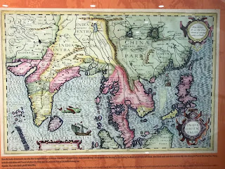
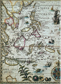
East India map by Pieter or Petrus in 1594

This map drawn by Petrus or Pieter in 1594 shows the two archipelagos of Paracel and Spratly.


The India Orientalis (East of India) was drawn by Jodocus Hondius in 1613. On this map, Paracel and Spratly islands were connected like a blade.

In the map made by Jodocus Hondius in 1613, the Frael (Paracel) archipelago includes all the islands located from the Tonkin Gulf to Vietnam’s southern sea, except for Condor (Con Dao) and Pulo Cici (Phu Quoc), which were drawn separately.

Carte de l'Asia map by Homann Heirs in 1744

Carte de l'Asia (Map of Asia) was created by Homann Herrs in 1744. On this map, the Paracel Islands (including the Spratly Islands) is noted as "I. Ciampa," which stands for "Islands Ciampa”, meaning "The islands of the Kingdom of Ciampa". Ciempa or Campala are the names of the Cochin called by Western countries at that time since they believed that this kingdom was the old land of the Champa Kingdom.

         
        The Great Annam Map

The Great Annam Map, by Bishop Jean Louis Taberd in 1838 has the caption Paracel seu Cat Vang (Paracel means golden sand), which was written in Chinese, standard Vietnamese and Latin languages. Bishop Taberd is the author of an article in The Journal of the Asiatic Society of Bengal, volume 6, second part, 1837, published in Calcutta, which confirmed "Paracels or Pracel belongs to Cochinchina" – that is, to Vietnam. The original map is now kept at the Richelieu National Library in Paris, France.

That’s the implicit way that the world has recognized that the Paracel Islands truly belong to the sovereignty of Vietnam for at least the past five centuries.